
AR XREAL One Pro Glasses (size L)
0,00 €

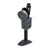
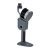

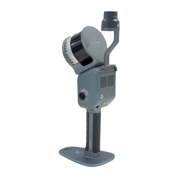
XGRIDS Lixel L2 Pro 32/300
The new Lixel L2 Pro combines vision, LiDAR and IMU modules with artificial intelligence to deliver a real-time point cloud of comparable quality to post-processed data. Thus, it ushers in the "era of zero post-processing" for SLAM devices.
Real-time precision
The Lixel L2 Pro is a fully integrated and optimized device that delivers a point cloud in real time, eliminating the need for data processing. Using the LixelUpSample™ algorithm, it generates photorealistic, color point clouds with a density of 1 million points/m² and a precision of 1 mm, capturing every detail with the highest accuracy. In addition, the 5-millimeter thickness of the point cloud provides even better shape reproduction, significantly improving the quality of mapping and line drawing.
SLAM reliability in any environment
Thanks to its advanced Multi-SLAM algorithm, the L2 Pro performs well even in the most demanding conditions. The device provides constant access to absolute coordinates in areas with limited access to satellite signals, such as building interiors, tunnels and subways. Stable mapping and high accuracy remain consistent even in degraded environments, making the L2 Pro a reliable tool for professionals working in dynamic and challenging environments.
LixelGO mobile app
LixelGO is an intuitive app for managing the data collection process. It allows one-click control, camera image viewing, verification of the height and color of the point cloud, and monitoring the status of the device.
Lixel Studio - point cloud processing software
Lixel Studio is an advanced 3D point cloud processing software that uses AI algorithms. It offers tools for editing, registration, noise removal, measurement and 3D cropping. It supports map fusion, panoramic overlays and various rendering modes (RGB, intensity, height, EDL). It automatically generates accuracy reports and provides features tailored to various industries, such as volume measurements and automatic meshing.
Included
General
Features
File Format
Accuracy in Real Time
Accuracy after Processing
LiDAR
Camera Panoramic Photos
Battery
Charging
Tietolomake
5 samassa luokassa: muut tuotteet:


Arvostelut (0)